The Great Appropriation | La grande appropriation (2020-ongoing)
In many non-Indo-European languages, there is no word for the noun land, void of all material substances and social relations. For example, indigenous highlanders in the Indonesian island of Sulawesi have words that refer to more specific qualities, such as soil, primary forest, tilled garden, grassy patch or barren zone.
When Europeans began seeking control over territories beyond their own, they brought with them their manner of dwelling and sought to impose property regimes on colonial settlements, based on clearly demarcated territories inscribed in legal documents. These regimes were grounded in a logic that combined a geometrical framing of space along with its simultaneous appropriation, a process that led to a fundamental redrawing of the ways that human and nonhuman collectives relate to the land, and to each other.
Such forms of territorialisation were made possible at the turn of the 16th century by new modes of inscription - mapping and surveying - that transformed the concept of land from something concrete and relational into something fundamentally abstract. Reduced to pure geometry, any land could be measured and described in precise, mathematical terms. Coloured squares and rectangles stood-in for complex milieus, erasing everything beyond a two-dimensional plane.
Drawn to scale, the map and the cadastral survey made it possible to view territory as disembedded from lived experience and social relations. Presented as something that could be marked and divided, cut-out from the interconnectedness of the world, such technologies facilitated the displacement and dispossession of peoples, plants, animals, and other life forms through the establishment of a system of agriculture and extraction connected to global commerce.
On Turtle Island, or what they called New France, the settlers referred to the making and marking of territory as the seigneurial system - an institutionalised form of land appropriation, distribution and occupation. It was a commercial company, the Compagnie des Cent-Associés, which was first granted the right to allocate areas of this territory from the Arctic to Florida. After France ceded this land to Britain in a treaty signed in Paris in 1763, the British township system took over the task of opening up new land for colonization.
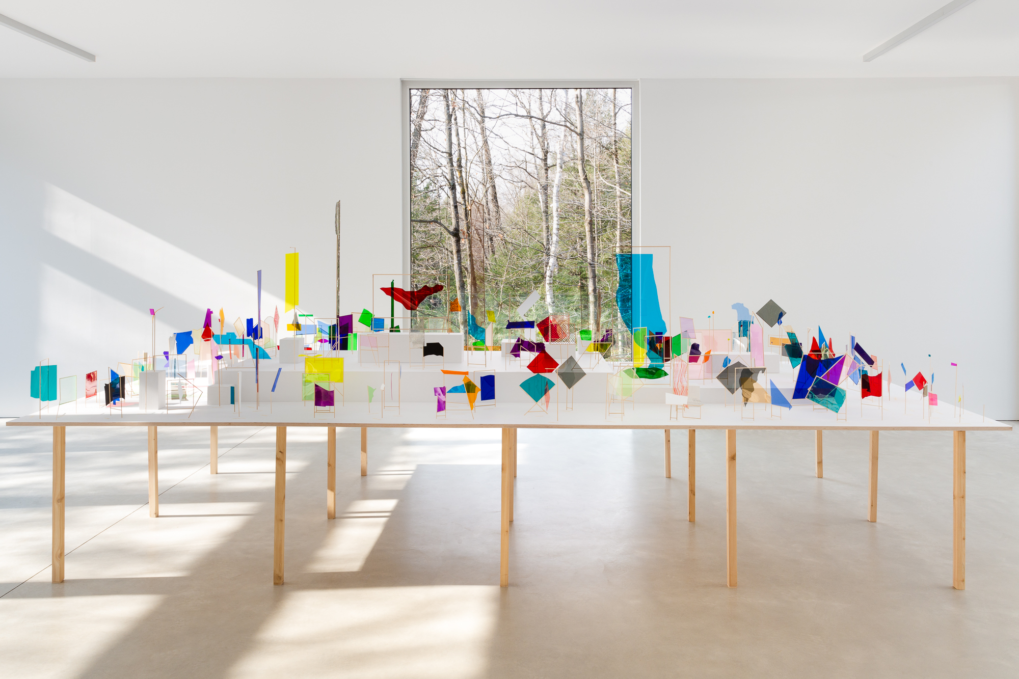
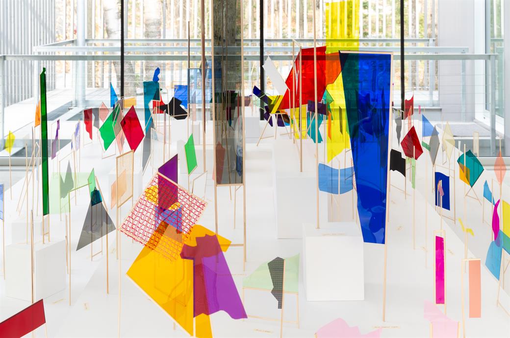
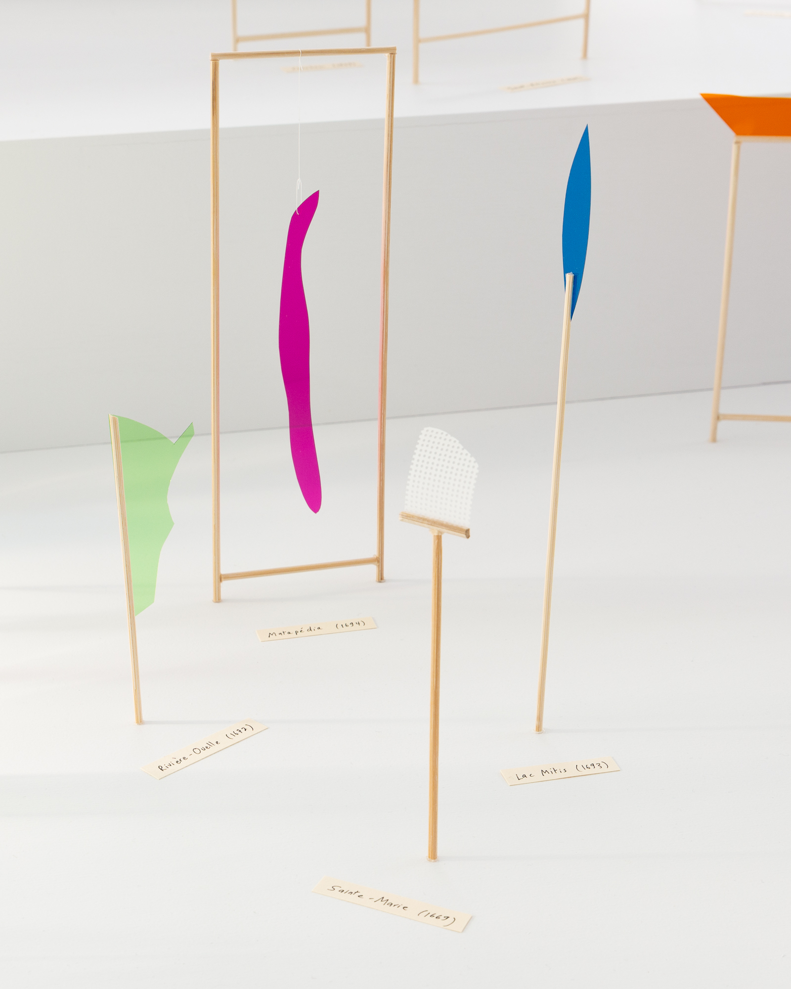
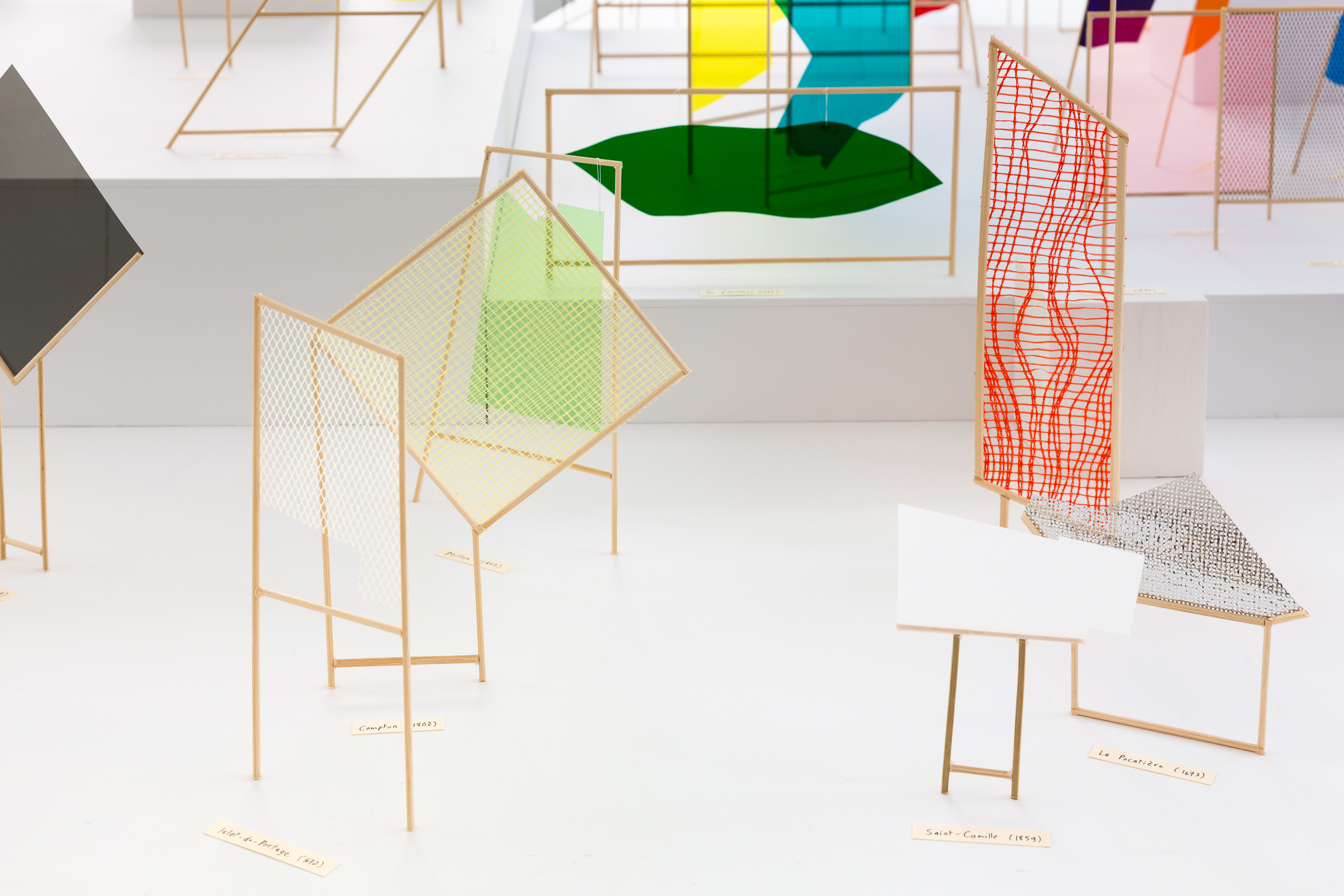
La grande appropriation is an installation that consists of more than three hundred sculptures, each representing a particular seigneurie or township. While the French preferred elongated rectangles, the British where happiest with squares. The violence of this appropriation is historical, but the current ecological crisis and inequalities in access to and governance of the land, are linked to its ontological, technical and legal foundations.
La grande appropriation, 2020-ongoing, installation: bamboo, acetate, thread, mesh. Installation view, Grantham Foundation for the Arts and the Environment, Saint-Edmond-de-Grantham, Quebec.